
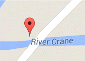
450, Staines Road,
Hounslow, Middx.,
TW4 5RB
Hounslow Heath
In 1545 Hounslow Heath extended into the 'fields, parishes, and hamlets' of Isleworth, Brentford, Heston, Hounslow, Twickenham, Teddington, Hampton, Hanworth, Feltham, Bedfont, Cranford, Harlington, Harmondsworth, and Stanwell.
The Heath been a royal hunting ground, the site of military camps, the hide out of highway men and women, and the home of an airport. The eventual mapping of the whole of the United Kingdom by the Ordnance Survey began by General William Roy with the measuring of an accurate base-line on Hounslow Heath, which was chosen for its flatness and proximity to the nearby barracks. An excellent historical blog titled A Very Large Ground: enclosure, resistance and disorder on Hounslow Heath by Mudlark121 relates the heaths history from 1545.
The small surviving fragment of the Heath was made a local nature reserve (LNR) in 1991.
More information can be found :
- from London Borough of Hounslow About the Heath
- Friends of Hounslow Heath - can be contacted here