The landscape of the lower Crane Valley today reflects its history and past use been recognised in the designation of Archaeological priority area (APA) by English Heritage (EH). Crane Valley Park EH APA maps, west to east: 1, 2, 3, 4
The Influence of man on the River Crane
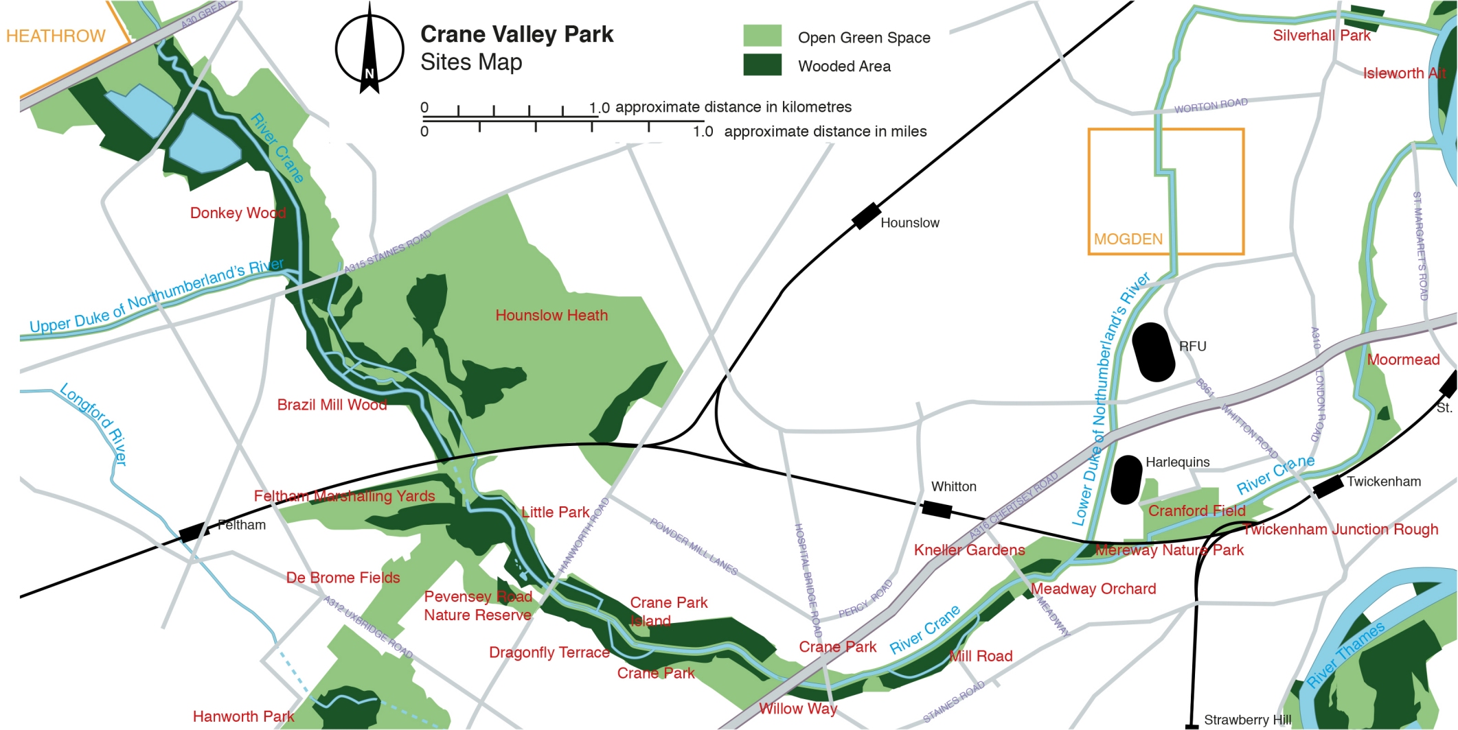
Man's influence on the history of the River Crane can be seen in some of the place names in current use - for example farms have given their names to Marsh Farm Road and the Butts Farm Estate; and old industries are represented by Powder Mill Lane, Mill Road and Feltham Marshalling Yards. Mereway Road indicates where the river was widened and Mereway Bathing Place was established and Craneford Way marks where there was once a ford across the River Crane. Hospital Bridge Road is close to the site where King James II set up a field hospital for his troops in 1688 before he fled abroad. There are also lost names for example Warren Farm Lane ran past the mill at Mill Road to Warren Farm. The lane is still used and currently leads to Lincoln Avenue.
Mills along the River Crane
The mills along the river made use of it as a source of power for a thousand years. All of them were using water power for an industrial process, including flour milling, copper production, sword making, milling linseed oil, paper making and the production of cattle cake, as well as the best known local industry of gunpowder. Many of the mills were associated with the Duke of Northumberland whose family owned rights on the River Crane from 1553 until the 20th century. Their remains can be found in Donkey Woods, Brazil Mill Woods, in Crane Park near the Hanworth Road, and at Mill Road. On the Duke of Northumberland’s River in Isleworth there was a large flour mill, Kidds Mill, at the confluence with the Thames.
The Duke of Northumberland’s River is an artificial channel that pre-dates the Duke, being constructed in the early 16th Century to take water from the River Colne to Isleworth. The Duke’s river had water mills all along its course and the water also fed the fish ponds at Syon. In 1931 the Duke sold his rights to both the Crane and the Duke of Northumberland’s River to Middlesex County Council.
The Longford River is a 12 mile stretch of artificial waterway that runs from the village of Longford near Heathrow Airport through Bedfont, Feltham, Hanworth and Bushy Park, Hampton Court Palace, and finally the Thames. The river passes through the Crane catchment but does not connect with the Crane, both share links to the Duke of Northumberland’s River. It was created in the 1630s and first talk by Rich Clarke is about the history. Rich's second talk explored the Longford River's mysteries and extrapolated the lost route of the river using local landscape features and pre-existing waterways. If you would like to discuss or input to these talks, please email using the address below to be put into contact with Rich.
The old sites of mills on the river can be found in the landscape. Evidence of the extensive Hounslow Powder Mills, in the form of blast mounds, grinding wheels, sluice gates and the Shot Tower, can be seen in Crane Park. These mills produced gunpowder for military and sporting use, on a site of more than 100 acres, between 1766/8 and 1927.
Flooding on the River Crane
The River Crane has always been prone to flooding as its clay catchment provides a rapid run-off response to rainfall. This effect has been accentuated in the last 100 years by increased urbanisation, leading to more artificial drainage and hard standing. In the 1800s the natural flood plain of the lower Crane extended across a large part of the adjoining market gardens and, as these were sold off for housing, flooding became an issue – with floods reported in 1892, 1895, 1903, 1914, 1916 and 1920. Eventually, from the 1920s, work was done to deepen, straighten and canalise the lower reaches of the river as a means of controlling the flood risk. This work was reportedly done for free by a local gravel contractor, and resulted in a deep and wide rectangular channel from Kneller Gardens to the far side of the A316.
There has been no flooding since this time – however a side effect has been to greatly reduce the environmental and aesthetic value of the lower Crane. FORCE hopes to see the re-instatement of more natural banks in the future, with flood protection levels maintained or enhanced.
Learn more about the fascinating history of the River Crane by looking at the history of individual sites by following the menu links or from the map below - click on the appropriate area of the map.
| Select a site ... click on the appropriate area of the map below |
Click the button on the right for a higher resolution site map. |